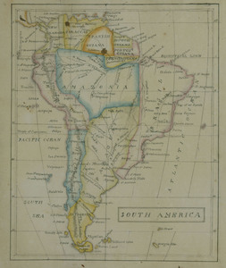
Map of South America by Lucretia Deming
Object ID:
1950-01-90d
Category:
Made by Students
Medium:
watercolor and ink on paper
Creator:
Lucretia Deming (1804-1887)
Date:
1825
Held at:
Litchfield Historical Society
Associated Place:
Litchfield, CT
Size:
9 3/4" length x 11" width
Description:
Map of South America in 1825. Continent drawn on paper in ink with bisecting ink lines of latitude and longitude. Countries of continent outlined in different colors of watercolor paint. Major cities and waterways labeled in ink.
Associated People
- Lucretia Deming
Made by
Contact Us
Do you have more information for the Ledger?
If you have family papers, objects, or any other details you would like to share, or if you would like to obtain a copy of an image for publication, please contact us at curator@litchfieldhistoricalsociety.org.